Log in
All resources
Create a design
55,001 Free Images of Old Map
17th-century paintings of old testament
bibliothèque nationale de france
old maps of delfland
nicolaas samuel crucquius
17th-century religious paintings in germany
old maps of the hague
david rumsey historical map collection
maps by willem and johannes blaeu
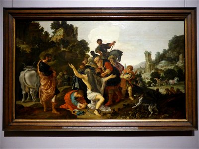
orazio gentileschi
17th-century paintings in the alte pinakothek
18-year-old human males
sitting people
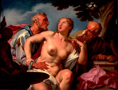
17th-century paintings of susanna and the elders
orazio gentileschi
16th-century oil on canvas paintings in italy
16th-century religious paintings in italy
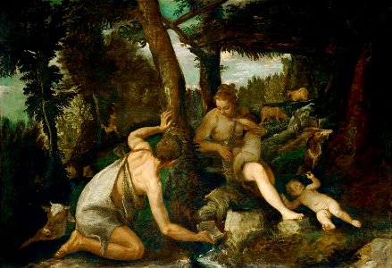
16th-century paintings of adam and eve
1580s religious paintings
religious paintings in salzburg (state)
1580s religious paintings
1696 oil on canvas paintings
curtains in art
17th-century religious paintings in germany
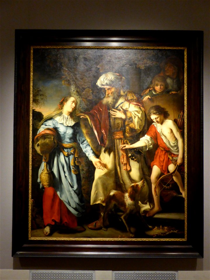
hagar
old testament paintings by jacopo amigoni
cushions in art
lindenhof (quarter zürich)
albi
paintings of people in nature
god the father
17th-century religious paintings in germany
frame painting
facing left
berlin
17th-century religious paintings in germany
people with fire in art
17th-century religious paintings in germany
frame painting
1910s oil on canvas paintings in russia
1910 paintings from russia
men facing right and looking right
cambridge
henry hardinge, 1st viscount hardinge
francis holl
maps of spain by tomas lopez
1780 maps of spain
maps of the russo-japanese war
vladimir taburin
maps of polders in south holland
old maps of westland
the hague in the 1830s
old maps of the hague
topographia austriacarum (merian)
baroque
fra mauro map details
fra mauro map
maps of spain by tomas lopez
1780 maps of spain
atlas des anciens plans de paris by imprimerie nationale, 1900 from the david rumsey historical map collection
maps of paris from the david rumsey historical map collection
maps from the earth and its inhabitants, vol. iv
old maps of bristol
old maps of 's-hertogenbosch
details of old maps
russian empire in thomas kitchen's general atlas (1773)
general atlas (1773)
palatinatus rheni (merian)
baroque
maps by willem and johannes blaeu
old maps of gironde
ptolemy's 1st asian map
bologna ptolemy
old maps of france
old maps of lyon
1650s maps of taiwan
1654 maps
dutch golden age painting
paintings after rembrandt
russian empire in thomas kitchen's general atlas (1773)
general atlas (1773)
maps of paris from bibliothèque nationale de france
sheet 10 of the turgot map of paris
algeria in the 1880s
old maps of algeria
95-year-old human males
emma soyer
maps in the rijksmuseum amsterdam
published by frans buffa & zonen
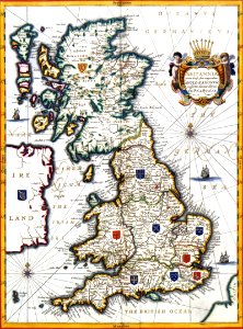
old maps of the british isles
victorian era
mannerism
jochebed
old maps of brabant
1666 in belgium
old maps of delfzijl
atlas van loon
maps by pieter van der keere
willem barentsz
paintings of judith with the head of holofernes
orazio gentileschi
the turkish empire in europe, asia and africa (1752)
history of bursa
old maps of ghent by jacques horenbault
old maps of sint-elisabethbegijnhof
maps of aboriginal australia
old maps of new south wales
old maps of suriname
elias spanier
maps in the rijksmuseum amsterdam
hendrik de leth
geoctroyeerde sociëteit van suriname
old maps of suriname
old maps of livonia
old maps of latvia
eran laor cartographic collection
old maps of canaan
old maps of japan
kimura kenkado
old maps of manhattan, new york city
jasper danckaerts
john rocque's 1746 map of london
history of london
maps by willem and johannes blaeu
old maps of coevorden
maps of polders in south holland
old maps of the hague
kobe foreign settlement
old maps of kobe
1876 maps
1884 maps
old maps of siberia
erik palmqvist
david rumsey historical map collection
17th-century maps of iceland
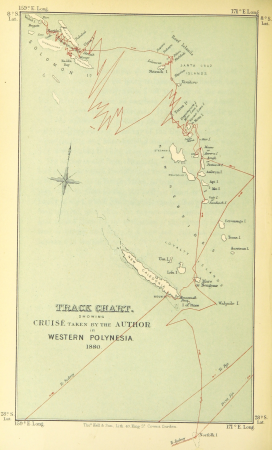
wanderings, south and east (1882)
old maps of polynesia
1816 maps
1684 maps
maps from university of amsterdam special collections
atlas der neederlanden
maps from the earth and its inhabitants, vol. xviii
old maps of valparaíso
maps from the earth and its inhabitants, vol. xviii
old maps of valparaíso
maps from the earth and its inhabitants, vol. xvi
old maps of central america
atlas des anciens plans de paris by imprimerie nationale, 1900 from the david rumsey historical map collection
maps of paris from the david rumsey historical map collection
atlas des anciens plans de paris by imprimerie nationale, 1900 from the david rumsey historical map collection
maps of paris from the david rumsey historical map collection
old maps of leiden
baroque
cartes de franz schrader
1894 maps of france
maps of midden-delfland
foppenpolder
maps from university of amsterdam special collections
atlas der neederlanden
old maps of verona
adriano cristofali
details from maps by gerardus mercator
maps by hendrik hondius the younger
old maps of the bering sea
old maps of kamchatka
maps of brazil by hendrik hondius
old maps of bahia
cornelis de jode
1578 maps
maps in the library of congress
1861 maps of the united states
engravings of buildings
maps by pieter mortier
17th-century maps of south asia
maps by alexis-hubert jaillot
damascus in the 1750s
old maps of damascus
paintings of old testament by rubens
flemish baroque painting,baroque
cartes de franz schrader
old maps of france
old maps of friuli-venezia giulia
maps of carniola
midden-delfland in the 18th century
maps of midden-delfland
maps by willem and johannes blaeu
old maps of swabia
maps from the earth and its inhabitants, vol. xi
old maps of the sahara
old maps of the eastern hemisphere
1710s maps of the world
maps from the earth and its inhabitants, vol. iv
old maps of edinburgh
maps from the earth and its inhabitants, vol. iv
old maps of edinburgh
1882 in london
port of london
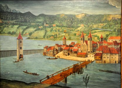
old maps of ulm
philipp renlin
nicolas desmarest
ambroise tardieu
joseon dynasty
heo mok
old maps of the northern hemisphere
old maps of the arctic
sanborn maps of manhattan published in 1904
old maps of west houston street (manhattan)
15th-century maps of africa
fra mauro map details
maps from the earth and its inhabitants, vol. vii
old maps of jiangsu
9901 - 10000 of 55,001
Next page
/ 551


![Map 17 [Tabula 17], 1477](https://cdn.creazilla.com/illustrations/10001044525/map-17-tabula-17-1477-sm.jpg)


![[Facsimile of part of Turgot's plan (Laune district) used as advertising for the Becker fils house]](https://cdn.creazilla.com/illustrations/10000809874/facsimile-of-part-of-turgot-s-plan-laune-district-used-as-advertising-for-the-becker-fils-house-sm.jpg)